
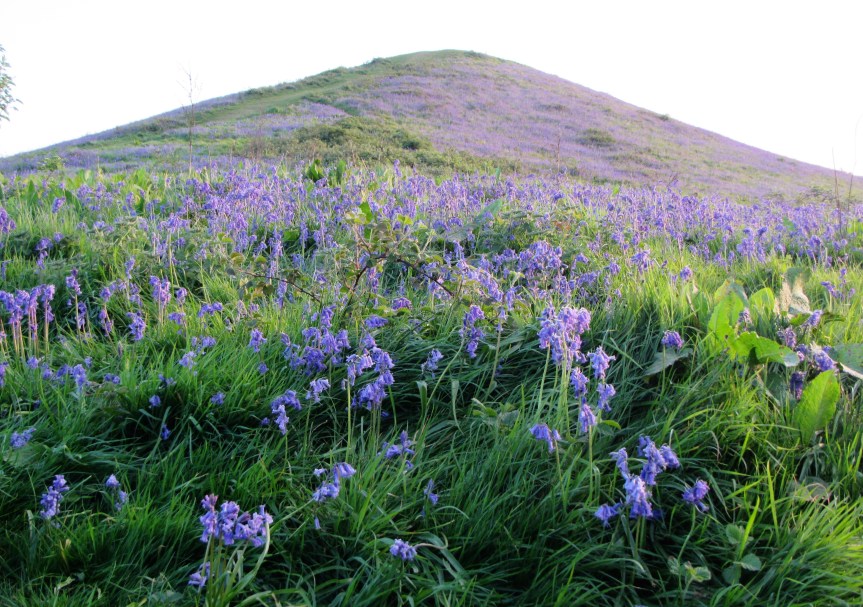
On a beautifully sunny day, it can be hard to tell where the bluebells end and the sky starts when gazing at Cam Peak at this time of year. This hill, which is shaped unlike any other in the district and can be seen from miles around, is cloaked with vivid blue all the way round and is truly worth a visit. Especially as it’s so easy to drive to and to park. Local legend tells the story of the Devil pushing a wheelbarrow of soil through Cam with the intention of using it to block the estuary. The Devil stops to ask a local man how much further is the estuary. The quick-thinking man, realising what the Devil is plotting, says that he still has many miles to walk, so the Devil gives up in frustration and empties the wheelbarrow content on the ground creating Cam Peak.
The Peak nestles against the end of the Long Down, though the two aren’t geologically the same. The Long Down was part of the Cotswold escarpment many thousands of years ago but separated by erosion by a stream or river in the past. It’s made of limestone and the plant life growing on the top makes it a site of international importance – including rare species found in few other places.
Don’t panic when you look at the Peak! You can take the steep path straight up to the top, but I’d recommend walking the path around the base – apart from being a lot easier, you also get to see far more bluebells and enjoy the full spectacle. You’ll also be able to spot many other flowers growing amongst the bluebells, too. When you’ve almost walked all the way round the Peak, look for a path on your right which takes you towards the Long Down. For fabulous views over the Severn Estuary, follow the Cotswold Way sign to get onto the top of the Down. Otherwise, take the path to the left (and then the centre one when you have a choice of three) to walk around the base of the Down and see yet more swathes of bluebells.
To get the best of both, I’d recommend taking the Cotswold Way path, then walk to the far end of the Down (which is more or less flat) and follow the Cotswold Way to take you down the side. Turn right and the route will take you through yet more bluebells and along the base of the Down, returning to the meeting point with the Peak. Turn right to walk to the car park. Just to the right of the car park (as you walk from the Peak) is a lovely pond restored by the volunteers and staff of Stroud Valleys Project. It’s fenced off so a climb over the stile is necessary to reach it. But it’s worth a visit.
Time of Year: first two weeks of May (though if the winter has been warm, try the last week in April and first week in May). The bluebells will definitely have finished flowering by mid-May.
Location: Springhill, Upper Cam. OS Explorer Map 167, grid reference SO 768995. The car park is on the right of Springhill (the road name), at the base of the Peak, and has room for quite a few cars.
How long to be there: Allow about an hour and a half walking for a stroll around both the Peak and the Down.
Terrain: the paths around both the Peak and the Down are more or less flat. An all-terrain buggy could easily be pushed around the Peak and possibly the Down, though the path does become narrow. Someone with limited mobility, but who could walk, may possibly make it around the Peak with someone’s arm to lean on. However, the full splendour of the Peak can be enjoyed just by standing in the car park (there’s no bench there, unfortunately).
Facilities: None, though the Old Lodge Inn is very close by which is a lovely pub and has toilets.
Directions: from A38, turn off onto A4135 and drive into the centre of Cam. At the roundabout, go straight on (left is Tesco) past the Berry Blue cafe and community centre, then keep left at next junction following signs to Upper Cam. Follow road through Upper Cam and just past church on right hand side, turn left onto Springhill (you’ll see the Peak easily now). Stay on this road, and after a sharp swing to the left, look out for the car park on the right hand side.


